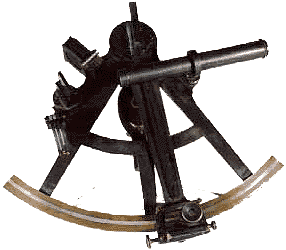
Sextant
mmbc 984.34.1
Since the earliest sailors took to the high seas, the problem of how to keep track of one's location on an ocean with no permanent landmarks presented itself. At first the sailors simply didn't go out of sight of land. This worked fine in terms of getting
a fix on their position but it presented serious limitations to sailing.
| Probably the first instrument used was the compass. The Chinese discovered that a needle with a magnet on one end always pointed the same direction, north. At least now they could know what direction they were headed in, and if you knew that and you multi plied your speed by your time spent traveling you could deduce your position. This is called 'Dead Reckoning' and was used regularly well into this century. However it wasn't terribly accurate since it relied too much on estimates of speed. |
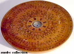 A Chinese compass mmbc 2263 |
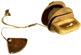 An early log from the museum's collection mmbc 991.104.0004 |
As a method of measuring speed, a log was thrown off the stern with a rope
attached. On the rope was a series of knots spaced a fathom apart. As the log was left behind, it pulled the rope out with it. Although not readily used today, the term 'log' has car
ried forward into the present day. Hence the term 'logbook'.
The length traveled in 3 minutes was measured by how many knots passed overboard, thus how many knots you were traveling, a unit still in use today. Again this wasn't totally accurate since it didn't take currents into account and because the length of a fathom was totally arbitrary. |
A fathom, by definition, was the span from finger tip to finger tip (or height) of the sailor using the rope. This unit was also used to measure the depth of the ocean in your location. A weight with a line attached was thrown overboard and let down u
ntil it touched bottom. It was then hauled back up hand over hand counting the spans or fathoms of depth. Only much later on was a fathom defined as 6 feet.
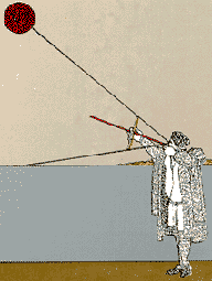
| By using these methods, the sailors had a rough idea of where they were, but it still wasn't accurate. Some sailors had for a long time used the sun ,the stars and the moon to deduce position. By observing the position of the noonday sun in the sky one co uld deduce how far north or south of the equator one was. |
 Navigation by the stars! |
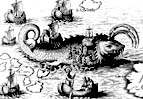 Brrrrr scary |
The Arab sailors and mathematicians were the first to work this out systematically. They were much more advanced at the time in mathematics, they knew the earth was a sphere (where as the Europeans of the time had certain superstitions about this) and the y were great sailors. They divided the earth into a grid, with lines of latitude running east-west parallel with the equator and lines of longitude running north-south from pole to pole. |
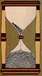 An hourglass |
They also invented the astrolabe (which was impractical for use at sea) which measured the angle from the horizon to the heavenly body (e.g. the sun). Later on, a device called a cross hatch was used, which lead to the development of the modern day sextan t. They devised tables of observations to interpret the readings taken with the new instruments they created. |
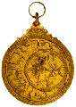 An astrolabe |
| So if you knew where the sun should be at a given time (that's where all those tables came in) and you had an accurate way to measure the actual angle at a given time you could compare the two and find a co-ordinate, or in the case of the noonday sun exac tly how many degrees away from the equator you were and in what direction (e.g. 48° north). If you did the same again for the north star you could find out how many degrees east or west of the Greenwich line you were (e.g. 123° west). If you use the two points together you can pinpoint your location on the globe. So for instance the Maritime Museum of B.C. Is at 48° 25' north by 123° 22' west. Minutes (there are 60 in 1 degree) were later added as this method became more and more accurate . |
 A crosshatch |
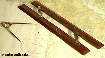
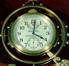 A chronometer mmbc collection |
Initially, one problem with this technique was that one needed an accurate way to tell time. Early clocks used a pendulum which didn't work very well at sea. Hour glasses were used but they had to be turned, well, every hour ; so if someone forgot then th ey lost track of the correct time and the accuracy of their readings suffered. The development in the 18th century of the chronometer (an accurate ship board clock) made navigation an exact science. |

![[English]](../simages/english.gif)
|

![[French]](../simages/french.gif)
|

![[Credits]](../simages/credit.gif)
|

![[Feedback]](../simages/feedback.gif)
|