
 Throughout most of the 1800s it was felt that the United States was a major
threat to British interests in North America. To quote British documents, a fort was
required in "Defence of the Dock Yard and Naval and Commercial harbour of
Kingston."
Throughout most of the 1800s it was felt that the United States was a major
threat to British interests in North America. To quote British documents, a fort was
required in "Defence of the Dock Yard and Naval and Commercial harbour of
Kingston."
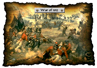
After the War of 1812, Britain and the United States did not begin instant cordial relations. A "cold war" state developed and both countries eyed each other uneasily. Anglo-American rivalry led to a succession of wars and border raids. Fort Henry is but one of a number of forts that attest to these hostile relations. It is anachronistic to speak of Canadian-American relations prior to 1867 as it was Anglo-American rivalry that spurred fortification construction.
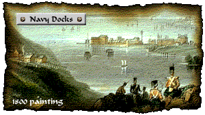
Kingston was a place of strategic importance because it was a control point on the greatest and most important natural communication system in North America: the St. Lawrence River-Great Lakes waterway. Kingston was strategically located at the head of the St. Lawrence River and could therefore control the entry of ships into the Great Lakes. It also stood directly opposite the major American bases and could be used as a centre from which to monitor, blockade, or attack these bases. Kingston’s natural harbour offered a secure depot from which warships could have contested a sea-borne invasion. In 1788, Kingston became the site of the Royal Naval Dockyard which serviced the Royal Navy’s Lake Ontario fleet. The dockyard was situated at the site of the present-day Royal Military College (R.M.C.).
The strategic importance of Kingston was increased with the opening of the Rideau Canal in 1826, which provided a safe supply line to Lake Ontario and the Upper Canadian interior. Previously British ships had been forced to move along the St. Lawrence River from Montreal to Kingston. Along most of this route, the river was bordered, on one side, by the United States. In some places, the river was so narrow that enemy shore batteries could prevent ships from passing.
MAP:
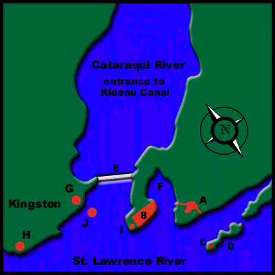
| A= FORT HENRY |
| B = NAVY DOCKS |
| C= CATHCART REDOUBT |
| D= CEDAR ISLAND |
| E= PENNY BRIDGE |
| F= NAVY BAY |
| G=MARKET BATTERY |
| H=MURNEY TOWER |
| I=FORT FREDERICK |
| J=SHOAL TOWER |
In order to protect the dockyards, warships and the entrances to the canal and the St. Lawrence River, the British decided to improve Kingston’s fortifications. The area chosen was at Point Henry, the highest point of land facing these sites. Point Henry was named after Henry Hamilton, Lieutenant-Governor of Lower Canada, 1782 – 1785.
The harbour of Kingston, and thus Fort Henry, was therefore the key in the defence of Upper Canada, and to some extent Lower Canada.
 Go to Tactical and Strategic Planning
![]()