|
Old Crow: Land and Environment |
![[Digital Collections Website]](../box.gif)
|
|
|
Old Crow: Land and Environment |
|
Old Crow Basin, in northern Yukon territory is important for the richness of its fossil record and the discovery there of some of the oldest artifacts in Canada. During the last major glacial period (the Wisconsin), the basin was occupied by a single large lake in which a thick layer of clay was deposited. When the glacial lake drained, about 12,000 years ago, Old Crow River cut through the clay and deeper, older layers of material creating vertical bluffs more than 30 meters high. Hundreds of thousands of fossils, representing many varieties of plants, invertebrates and vertebrates, were eroded from the layers beneath the lake clay. Many fossils were redeposited in and on newly formed riverbanks and bars. Among the vertebrate fossils are bones that bear the distinctive marks of breakage and cutting by people who may have killed or scavenged the animals. These bones have been radiocarbon dated and indicate an age of 25,000 - 30,000 years. The analysis of these fossils yields a record of environmental change spanning more than 100,000 years.
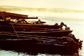
Boats on the Porcupine River.
Yukon Government photo.
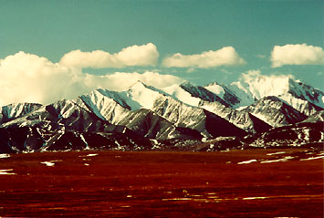
Old Crow Plain, about 5000 sq kilometers, elev 300 m, referred to locally as Old Crow Flats, is the northernmost part of the Porcupine Plateau in the Yukon, lying North of the Arctic Circle and 150 kilometers South of the Beaufort Sea. The name honours the memory of a Gwich'in chief from long ago. The plain is pristine wilderness area underlain by continuous permafrost and covered with a myriad of shallow lakes and ponds, some of which have an oriented rectangular shape related to prevailing wind directions and to patterned ground phenomena, e.g., polygons and wedges.
The vegetation is of the tundra type with outliers of the boreal spruce forest; willow thickets line the course of the Old Crow River. Geologically the plain represents the floor of the intermontane Old Crow Basin, a structural depression of the Tertiary age linking the eastern and interior systems of the Cordillera. The basin is bordered on the east by the Richardson Mountains, on the north by the British Mountains, and on the west and south by the Old Crow Range. The underlying sediments include a veneer of Holocene and Pleistocene clay, silts, sands, and organics overlying a thick sequence of Tertiary, Mesozoic and Paleozoic sediments, some of which are potentially oil bearing. The basin was one of the few areas in Canada untouched by glaciation during the Pleistocene ice ages, and it served as a refuge for many ice - age animals. However, abandoned high - level shorelines indicate that the flats were inundated by proglacial lakes during the ice - ages. The modern Old Crow River, which joins the Porcupine River at the Indian village of Old Crow, is a meandering stream with numerous cutoffs and a well - defined terrace system. The river bluffs have yielded an enormous quantity of mammalian bones, together with artifacts of prehistory.
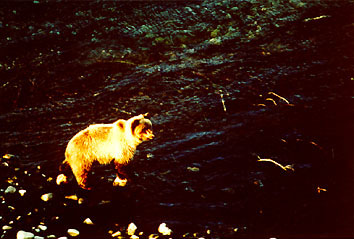
Grizzly bear fishing.
Yukon Government photo.
![[BACK]](../backicon.gif)
![[Home]](../homeicon.gif)
![[French]](../frchicon.gif)
![[Feedback]](../feedbico.gif)
![[Digital Collections]](../digcolic.gif)