A rugged yet gentle land of boulder-strewn barrens, tranquil forests, softly flowing rivers and shallow rock-studded lakes, framed by a rock-girded sea coast of world-renowned beauty.
THE LAND:
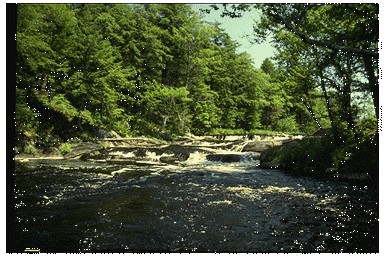
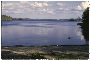
From the coast, the land gradually rises to a height of about 200 metres in a series of irregular waves of folded metamorphic rock. The Ice Age has left its footprints on much of the region, scraping away the fertility of the land and depositing it in the sea where today it nurtures rich fisheries. Coarse, stony, shallow soils, exposed bedrock polished and grooved by the crawling glaciers, and erratics strewn about like glacier-scats are the legacy left by the Ice Age. Rivers and streams and thousands of shallow, rocky lakes are found throughout the region.
VEGETATION:
Along a band of coastline 3-30 kilometres wide are dense, stunted forests of balsam fir, black spruce and white spruce. The growth of trees along the coast is slow because of the marginal soil, harsh climate and salt spray. White spruce, which are salt-tolerant, dominate along the most exposed areas. Large areas of bare rock, bogs and barrenlands have resulted from repeated fires. Isolated stands of old-growth hemlock forest are found throughout the region. Inland, mixed wood forests of red spruce, white pine, red oak and red maple are typical on well-drained sites. Although the combination of soil and climate is more conducive to growing trees here than it is along the coast, large barren areas and areas covered by low shrubs are still found. Fire and wind strongly influence the appearance of the vegetation in this region.
WILDLIFE:
Common large mammals include moose, white-tailed deer, black bear, snowshoe hare, red fox, porcupine, beaver, raccoon, martin and fisher. Before the turn of the century, caribou were plentiful throughout the region. But the combination of fires, agriculture, logging and settlement changed the region to a patchwork of forests, barrens and human habitations - ideal for moose and white-tailed deer but not for caribou.
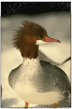
Salt marshes and tidal mud flats provide ideal feeding and resting habitat for migrating
waterfowl and shorebirds. The offshore frieze of islands and the indented coastline
provide a rich habitat for gulls,cormorants, terns, guillemots and other coastal birds.The
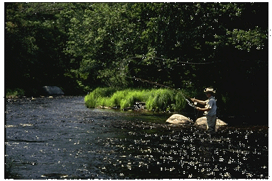
numerous lakes and streams are famous for speckled trout and runs of Atlantic salmon.
"The angler may obtain such sport as he perhaps never dreamed of", an eighteenth
century guide to Nova Scotia said of fishing in this region.
STATUS OF NATIONAL PARKS
The inland portion of this region is represented by Kejimkujik National Park (382 km2), established pursuant to a federal-provincial agreement with the Government of Nova Scotia in 1967. The island-studded lakes and smooth-flowing rivers of this park are linked by a network of canoe trails used for thousands of years by the Micmac Indians. Hiking trails wind through rounded hills and shady forests where groves of 300-year-old hemlock trees can still be found.Several outstanding petroglyph sites depict elements of Micmac and European culture.
The coastal elements of this natural region are represented by the Kejimkujik's coastal adjunct (22 km2) near Port Mouton. Pursuant to a federal-provincial agreement with the Government of Nova Scotia, this area was added to the park in 1988. One of the least-disturbed shoreline areas on the south coast of Nova Scotia, the Port Mouton lands feature extensive brackish ponds and broad tidal flats. The endangered piping plover nests on the beaches of this peninsula. Dense scrub, century-old spruce-fir forests and barren uplands provide a backdrop to the shoreline.