DOMAIN OF THE MUSKOX
Here I stand
Surrounded with great joy,
For the spirit of the air,
Lets glorious food sink down to me,
Here I stand"
song recorded on Victoria Island
by the Fifth Thule Expedition,
1924
THE LAND:
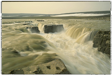
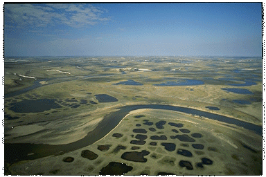
Low-lying, barren islands in the southwestern Arctic Archipelago distinguish this region. Victoria Island, the largest, is bigger than the four Atlantic provinces combined. The coastlines of these islands range from extensive lowlands to spectacular cliffs. Most of the area has been affected by the recent passage of the continental ice sheets. Fields of drumlins on southern Victoria Island impart a regular but complex "grain" that contrasts with the flat horizon of adjacent lowlands. Patches of undulating moraines, which appear from the air to be like gargantuan ploughed fields, break up vast plains where sinuous eskers provide the only vertical relief. Upland plateaux cut up into an Arctic version of badlands contrast with areas where nothing but broken limestone, sand and gravel are to be seen. Coal seams blacken the hills on Banks Island and loose chunks of coal are scattered on the beaches.
Most of this region is sparsely vegetated, with vast seemingly lifeless areas. Wet sites, however, have a heavy cover of sedges, cottongrass, mosses and saxifrages. In the southern fringes of the region, the thawed layer above the permafrost supports a thick layer of dwarf tundra shrubs. Dwarf birch, willow and alder can reach two metres in height. In windswept areas, trees - some as old as 400 years - grow horizontally, their branches twisted and convoluted and never rising more than a few centimetres above the soil.
WILDLIFE:
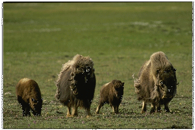
In winter, this land appears to be almost empty of life. The summer cacophony of bird calls is gone. Of the large mammals, only musk-oxen and caribou remain, steadfast in the face of the fiercest Arctic blizzards. Of the birds, only the raven, ptarmigan and a few snowy owls stay to face the cold and darkness. Beneath the snow, lemmings scurry along well-packed tunnels. But the surface of the land is still and silent. In summer the land comes alive under the benevolence of 24-hour sunshine. Caribou and musk-oxen get fat and bear their young in sheltered valleys. Flocks of snow geese and other waterfowl nest on the sedge meadows along river valleys.
STATUS OF NATIONAL PARKS:
An agreement for the establishment of Aulavik National Park was signed in August 1992 at a ceremony in Sachs Harbour, the only community on Banks Island. The park agreement was signed by representatives of the Inuvialuit, the federal government, and the government of the Northwest Territories.
Aulavik National Park comprises some 12,275 km2 of windswept tundra landscape - about twice the size of Prince Edward Island. The Inuvialuktun name was suggested by one of the elders of Sachs Harbour, and means "where people travel".
The core of this national park on northern Banks Island is formed by the relatively lush Thomsen River and its tributaries. The park also features deeply-cut river canyons and rugged, desert-like badlands. The hills and valleys surrounding the rivers support about one-quarter of the muskox on Banks Island, and some of the highest concentrations of muskox in the world. Archaeological sites dating from 3400 years ago are evidence of the area's rich cultural heritage.
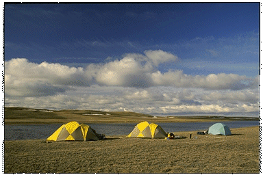
The most popular visitor activities in the park are travel by canoe or raft down the Thomsen River, and hiking the vast expanses of tundra in the core of the park.
| Steps in the Park Establishment Process | Status |
| Representative Natural Areas Identified: | done |
| Potential Park Areas Selected: | done |
| Park Feasibility Assessed: | in progress |
| Park Agreement Signed: | 0 |
| Scheduled Under the National Parks Act: | 0 |