Gary is an enthusiastic supporter of youth , technology and eco-tourism . He is the Chief Technology Officer at the City Of Surrey, BC, as well as the holder of other technology industry designations.
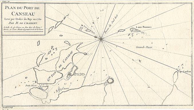
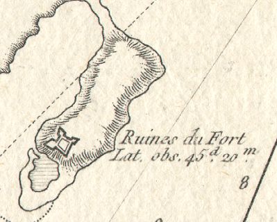
While vacationing with relatives at Black Duck Cove and Canso, Gary offered to digitize and transmit this engraving from a personal collection upon returning to the west coast . This digitized image is for the exclusive use of the "Grassy Island : A Step Back In Time" schoolnet project.
The Scott's commend the local digital collection initiatives and look forward to viewing the team's website via the net .
