 Name:
Name:
GOURLEY PARK
Location: the entrance to the park is at Duncairn Cres., off Brigadoon Dr., west of Garth St. and north of Stone Church Rd. W. - Ward 8
Survey Description: Concession 7, part of Lot 17, Township of Barton, City of Hamilton Park, Reference Plan 62R6385, part of Part 1, Reference Plan 62R13058, Part 2, Reference Plan 62R11417, Parts 1 to 9
Size: 2.98 hectares (7.36 acres)
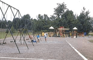
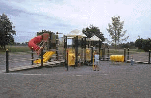
Features: multi-purpose court, play structure, swing, tennis court, walkway
History
 The name for Gourley Park was taken from a man named Colonel William Gourlay (1794-1867),
a farmer and part-time soldier who fought in the Rebellion of 1837. The neighbourhood where his farm was located was named after him, even though it was spelled with an "e" instead of an "a".
On July 29, 1975, the Board of Education traded Gourley Park for some land from the City.
The name for Gourley Park was taken from a man named Colonel William Gourlay (1794-1867),
a farmer and part-time soldier who fought in the Rebellion of 1837. The neighbourhood where his farm was located was named after him, even though it was spelled with an "e" instead of an "a".
On July 29, 1975, the Board of Education traded Gourley Park for some land from the City.
Gourley Park was also the location of a very special birthday party on July 1, 1991, as Hamiltonians gathered to celebrate Canada Day. Festivities included a "media" baseball game, featuring local radio and television personalities, as well as, face painting, a treasure hunt, games, races and lots of hot dogs!
In 1992 approval was given for some improvements to the park, including the installation of two tennis
courts and some fencing.
References:
1. Clipping Files. Hamilton - Parks - Gourley Park. Special Collections, HPL.
2. Corporation of the City of Hamilton, Department of Public Works and Traffic, Parks Division, Park Development Section. Parks Master Plan database, 1996.
3. Hamilton Mountain News. June 26, 1991. p. 9.
