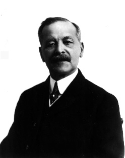
Title: Edouard G. Deville - Surveyor General of Dominion Lands Place: Ottawa, Ont.. Date: Mar. 1914.
PHOTOGRAPHER: Topley, William James, 1845-1930
National Archives of Canada, negative no. PA- 042833
Mapping the cordillera of the Canadian West has been a marvellous and formidable challenge to explorers and cartographers. This area was far from colonial bases in the East, and difficult to approach, whether from the interior or from the sea. Its relief, oriented entirely from north to south, is rugged and steep, and the prevailing weather conditions are often quite harsh. It was soon realised that the systematic surveying of the Rockies posed enormous problems. Surveying with a plane table, the traditional method at the time, required extremely stable conditions in order to take accurate sightings, and a long series of readings and observations. The surveyor often had to rely on his memory to supplement the notes he had taken at the site. All these a ctivities took time, and since it was difficult for the teams to travel in the mountains, an the weather was often poor, the work proceeded very slowly. And relying on one's memory was of little use to the surveyors of the Rockies, who faced a wide variat ion in the terrain. They realised that a new method was needed.
In 1885, Canada was fortunate in having as its surveyor general Edouard-Gaston Deville, a Frenchman born in 1849 who had emigrated to Canada in 1875 after a career as a surveyor and hydrographer in the French army and navy. After first serving as Quebec's inspector of Dominion Land Surveys in 1881, and surveyor general in 1885. Deville had taken a very early interest in the possible uses of photography for surveying. He quickly became an expert in descriptive geometry used in relation to photography. De ville built a sturdy camera adapted to Canadian conditions that could withstand long trips over the worst roads, and that required little adjustment once on site.
Land phototopography was relatively simple, requiring a specially designed camera placed on a perfect horizontal. Photographs were taken from different locations, at precise predetermined angles. Each photograph slightly overlapped the preceding one. Th e elevation of points of intersection on the photographs was measure, and this information already known about the position and elevation of each photography station and the geodetic control network. With enough photographs and points of intersection, and their elevation, the surveyor was able to draw contour lines (the lines on maps that unite points of equal elevation and thus provide topographic detail).
Phototopography quickly established itself because it removed one of the main obstacles to surveying in the high mountains: the lack of time available for surveying caused by the short summer, the strong winds and the frequent cloudy periods. With the n ew method, surveyors could take photographs of fairly large areas in relatively little time, doing the compilation and map drawing later in the Ottawa office.