Topographic map of the Ottawa region, 1925 - Government - Canada at Scale: Maps of our History - Exhibitions - Library and Archives Canada
 Library and Archive Canada - Bibliothèque et Archives Canada Français | Help     Canada  
 Home > Browse Selected Topics > Canada at Scale > Government
  Important Notices  
Government Cartography

GO

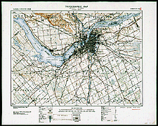
Topographic map of the Ottawa region, 1925

There was no grid of reference for producing a topographic map of the entire country before 1904, and it was not until 1927 that the National Topographic System of Canada (NTS) was established. The NTS led to the creation of maps at various scales. At a scale of 1:50 000, it takes 13,150 sheets to cover the whole country.

Catalogue entry:
Canada. Dept. of National Defence. Geographical Section.
31 G/6 [i.e. 5]: Ottawa sheet. — Scale 1:63 360. — [Ottawa] : Geographical Section, General Staff, Dept. of National Defence, 1925 (reprinted 1932). — 1 map : col. ; 44 x 62 cm, on sheet 60 x 75 cm. — (Canada inch to 1mile topographic map). —

Ref. No.: NMC 135552

n135552k

Previous   Next Return to Canada at Scale