Hydrographic chart of the Fraser River in British Columbia, 1994 - Government - Canada at Scale: Maps of our History - Exhibitions - Library and Archives Canada
 Library and Archive Canada - Bibliothèque et Archives Canada Français | Help     Canada  
 Home > Browse Selected Topics > Canada at Scale > Government
  Important Notices  
Government Cartography

GO

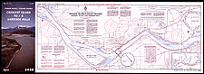
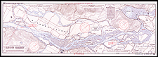
Hydrographic chart of the Fraser River in British Columbia, 1994

This is an example of a recent hydrographic chart produced by the Government of Canada.

Catalogue entry:
Canadian Hydrographic Service.
3488: Fraser River, Crescent Island to Harrison Mills = 3488: Fleuve Fraser, Crescent Island à Harrison Mills. — New chart Oct. 21, 1994. — Scale 1:20 000. — [Ottawa] : Canadian Hydrographic Service = Service hydrograhique du Canada, c1994. — 1 map : both sides, col. ; sheet 42 x 119 cm, folded to 42 x 20 cm. — ([Canadian nautical charts]). —

Ref. Nos.: NMC 183942, NMC 183943 (verso)

n183942k

n183943k

Previous   Next Return to Canada at Scale