If you take a
look at a map of Crooked Lake from 1959, you will see numerous creeks and
gullies located on it. Although today many of the creeks and gullies still
exist, a lot of them do not connect to Crooked Lake anymore.
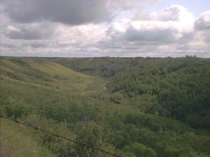
One of these
creeks is beside "Snake Road". The road is called "Snake Road" due to its
shape, as it winds down and around like a snake. The creek used to run
through the hills, under the road via a culvert, and feed into the lake.
Low water levels and beaver dams have since stopped the flow of water to the
lake.