|
![[Exploration header]](explore.gif)
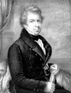
John Ross
- 1829-1833
John Ross
Accomplishments:
- during their years on Boothia Peninsula, Ross'
land parties journeyed along the east side of
Boothia Peninsula and charted the coast as far as
Kull Island
- in the west, they explored the coasts of King
William Island between Cape Norton and Victory
Point and sighted and named Cape Jane Franklin
and Franklin Point
- they travelled along the coasts of Matty Island
and charted the west coast of Boothia Peninsula
between Cape Porter and Cape Nicholas
- Ross determined the location of the North
Magnetic Pole as being, at that time, on Boothia
Peninsula at approximately 70ºN, near Cape
Adelaide
- Prince Regent Inlet was shown to be a bad
approach to the Northwest Passage due to the
unfavorable ice conditions in the Gulf of Boothia
Interesting Facts:
- for the first time a party had survived four
winters in the Canadian
North
- Ross closed Rae Strait on his map by an "isthmus"
linking King William Island and Boothia
- the possible effect of this error on the route
travelled by Franklin
in 1846 is open to speculation
- Ross had sailed previously in 1818, contributing
greatly to contemporary Arctic science
while proving the accuracy of Baffin's
observations
View
Voyage Route
Information
taken from Arctic Canada, Volume I, Third Edition, 1982
Image courtesy
of Mary F. Hamilton/NATIONAL ARCHIVES OF CANADA/C-123839
  ![Download Pkzip]](dlpkzip.gif)
|