| |
Ontario's
Water Shed
|
Rouge
River
|

Closer Look Index
|
Background
|
|
The Rouge River
system is one of the few remaining natural corridors linking
the Oak Ridges Moraine to Lake Ontario. It is among the largest
nature reserves in southern Ontario, covering an area of approximately
340 square kilometers. The watershed has twenty designated
Environmentally Significant Area's (ESAs) and three Areas
of Natural and Scientific Interests (ANSI). It is also within
the internationally recognized Metro Toronto Area of Concern
(AOC). |
|


|
In 1994, the Government
of Ontario announced the creation of the Rouge Park. At 11,600
acres, it is one of the largest parks situated in an urban
area. It is comprised of valley lands south of Steeles Avenue
and includes the Rouge River Marches. The headwater reaches
in the north however, remain largely unprotected. Since the
quality of the headwaters affects the quality of the river,
it is essential that tributaries flowing into the Rouge River
remain healthy. Increasing urbanization north of Metro Toronto
has meant that this is not always the case. Currently, a joint
project is on the way to rehabilitate selected headwaters
of the watershed. Initiated in 1996, the project focuses on
three tributaries, Rouge A, B and C, which are located just
north of Eglin Mills, between Yonge and Bayview in Richmond
Hill. |
|


|
The Eglin East Community in Richmond Hill
was approved for construction in the late 1980's. Building
the stormwater management system lead to the diversion,
channelization, hardening and or piping of the headwater
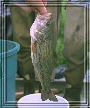
tributaries. These tributaries have been designated as cold
water fisheries. Channelization however, has resulted in
wide and shallow streams with little instream cover. The
slower velocity of the streams and reduced vegetation increase
the temperature of the water, which is detrimental to cold
water species such as brook trout.
|
|


|
Watercourse alterations
have resulted in the virtual extirpation of historical fish
and wildlife species. Rouge C remains the most natural of
the three tributaries however, it too suffers from polluted
stormwater run-off, poor habitat diversity, a lack of streambank
vegetation and encroaching urban development. The wildlife
community in the Eglin East Community now consists of urban-tolerant
species, some of which are exotic species. |
|


|
During the first
three phases of the project, the headwater streams underwent
significant habitat assessment and rehabilitation, including
garbage and debris removal, riparian planting and the installation
of a number of instream structures aimed at improving fish
spawning and rearing habitat. The objectives of the project
for 1999 are to restore and or enhance approximately 1.2 kilometers
of high value cold water fish habitat and to raise public
awareness that these are functioning river systems. |
|

|
More specifically,
Rouge C is one of the last naturally occurring brook tout
production zones left in the Rouge River watershed. Restoration
of the range of this species into A and B tributaries is proposed
and these areas could also support the provincially significant
redside dace. Thus works proposed are the rehabilitation and
re-channelization of Rouge A, as well as continued structural
introductions to Rouge C. |
|
|
|
