|
|
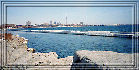
The Toronto and Region (formerly known
as Metro Toronto and Region) Remedial Action Plan area contains
six major watersheds draining into the waterfront and Toronto
Bay, including Etobicoke and Mimico Creeks, the Humber,
Don, and Rouge Rivers, and Highland Creek.
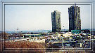
The greatest challenge in land use and
natural resource management, is the impact of urbanization.
Extensive urbanization and continued growth pressures in
the area have contributed to several use impairments such
as habitat loss and pollution.
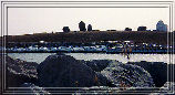
The area receives bacterial and nutrient inputs, heavy metal
and organic chemical contamination as a result of discharges
from combined sewers, storm sewers, and sewage treatment
plants. Agricultural non-point sources are problematic in
some of the upper watersheds. Due to urbanization, fish
and wildlife habitats require rehabilitation and protection.
|