|
|
English | Aide |
|
|
Avis importants |
| The History of Cartography Publié en novembre 1998, The History of Cartography illustre le raffinement cartographique dont faisaient preuve les sociétés traditionnelles. Curiosité intellectuelle et approche scientifique étaient des traits de ces cultures. The History of Cartography est l’ouvrage le plus avancé traitant de toutes les facettes de l’histoire de la cartographie. Notice
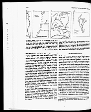
catalographique : Nos de réf. : C-146382a, C-146382b, p. 178-179 Source : The History of Cartography: Cartography in the Traditional African, American, Arctic, Australian and Pacific Societies, Volume deux, livre trois. Publié sous la direction de David Woodward et G. Malcolm Lewis. Chapitre 4, « Maps, Mapmaking and Map Use by Native North Americans.» G. Malcolm Lewis. The University of Chicago Press. ©1998, The University of Chicago
|
|
|
 |