|
|
Français | Help |
|
|
Important Notices |
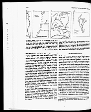
| The History of Cartography This volume of The History of Cartography, published in November 1998, illustrates the fine mapmaking skills of traditional societies. Intellectual curiosity and a scientific approach were among the traits of those cultures. The History of Cartography is the most comprehensive work ever published on all aspects of the history of mapmaking. Catalogue entry: Cartography in the traditional African, American, Arctic, Australian, and Pacific Societies / edited by David Woodward and G. Malcolm Lewis. — Chicago ; London : University of Chicago Press, 1968. — xxi, 639 p. : ill., maps ; 29 cm. — (The history of cartography, v. 2, bk. 3). — Ref. Nos.: C-146382a, C-146382b, pages 178-179 Credit: The History of Cartography: Cartography in the Traditional African, American, Arctic, Australian and Pacific Societies, Volume two, book three. Edited by David Woodward and G. Malcolm Lewis. Chapter 4, "Maps, Mapmaking and Map Use by Native North Americans." G. Malcolm Lewis. The University of Chicago Press. ©1998, The University of Chicago
|
|
|