Yakutat, Alaska, 1990 - Government - Canada at Scale: Maps of our History - Exhibitions - Library and Archives Canada
 Library and Archive Canada - Bibliothèque et Archives Canada Français | Help     Canada  
 Home > Browse Selected Topics > Canada at Scale > Government
  Important Notices  
Government Cartography

GO

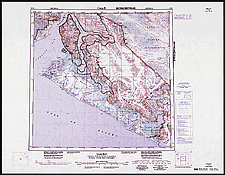
Yakutat, Alaska, topographic map at a scale of 1:250,000, 1990

Canada produces topographic maps at various scales. At the scale shown here, it would take 918 sheets to show the entire country. There is at least one edition of each sheet of this map.

Catalogue entry:
Canada Centre for Mapping.
114-O: Yakutat, Canada, United States of America / produced by the Canada Centre for Mapping, Department of Energy, Mines and Resources = 114-O: Yakutat, Canada, États-Unis d’Amérique / établie par le Centre canadien de cartographie, Ministère de l’énerigie des mines et des ressources. — Scale 1:250 000. — Ed. 2 = 2 éd. — [Ottawa : The Centre], 1990. — 1 map : col. ; 45 x 46 cm, on sheet 58 x 74 cm. — (Canada 1:250 000). —

Ref. No.: NMC 183939

n183939k

Previous   Next Return to Canada at Scale