

|
Copyright/Sources
Before reproducing materials, images and graphical elements from the National Library of Canada's website, please read the copyright information found on the Important Notices page.
Pathfinders and Passageways
Copyright/Sources, page 18
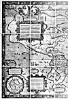 |
Nova et Aucta Orbis Terrae Descriptio ad usum Navigantium
, by Gerard Mercator, 1569
© Public Domain
Credit: National Archives of Canada / NMCO 17080
Source: National Archives of Canada
|
 |
Nova et Aucta Orbis Terrae Descriptio ad usum Navigantium
, by Gerard Mercator, 1569
© Public Domain
Credit: National Archives of Canada / NMCO 17080
Source: National Archives of Canada
|
![Map: ["Port Royal"], 1613, by Samuel de Champlain](../obj/h24/f1/nlc001137-v1.jpg) |
[Port Royal] by Champlain, 1613
© Public Domain
Champlain, Samuel de. Les Voyages de sieur de Champlain, Xaintongeois, capitaine ordinaire pour le Roy en la marine, depuis l'année 1608 jusques en 1612. Paris: Jean Berjon, 1613.
Source: National Library of Canada
|
![Map: ["Quebec"], 1613, by Samuel de Champlain](../obj/h24/f1/nlc001570-v1.jpg) |
[Quebec], 1613, by Samuel de Champlain
© Public Domain
Champlain, Samuel de. Les Voyages de sieur de Champlain, Xaintongeois, capitaine ordinaire pour le Roy en la marine, depuis l'année 1608 jusques en 1612. Paris: Jean Berjon, 1613.
Source: National Library of Canada
|
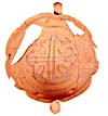 |
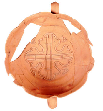
17th-century ceramic bowl found at Ferryland, Newfoundland
© J. Tuck
Reproduced with the permission of J. Tuck
Source: Newfoundland and Labrador Heritage
(www.heritage.nf.ca/exploration/redware.html)
|
 |
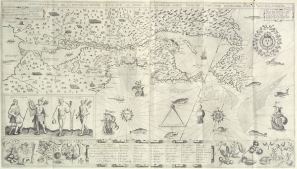
Carte geographique de la Nouvelle France
, by Samuel de Champlain, 1612
© Public Domain
Champlain, Samuel de. Les Voyages de sieur de Champlain, Xaintongeois, capitaine ordinaire pour le Roy en la marine, depuis l'année 1608 jusques en 1612. Paris, Jean Berjon, 1613.
Source: National Library of Canada
|
![Map: "Lac Superieur
," by the Jesuits Claude Dablon and Claude Allouez, [1672]](../obj/h24/f1/n0006407-v1.jpg) |
Lac Superieur
, by the Jesuits Claude Dablon and Claude Allouez, [1672]
© Public Domain
Credit: National Archives of Canada / NMCO06407
Source: National Archives of Canada
|
 |
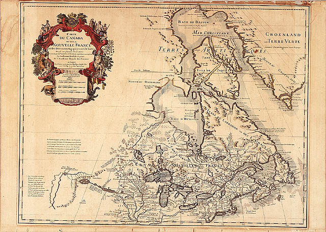
Carte du Canada ou de la Nouvelle France, 1703, by Guillaume Delisle
© Public Domain
Credit: National Archives of Canada / NMCO 11897
Source: National Archives of Canada
|
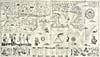
![Map: "Mappe monde géo-hydrographique
," by Pierre Mortier, [1700]](../obj/h24/f1/n0021098-v1.jpg) |
Mappe monde geo-hydrographique
, by Pierre Mortier, [1700]
© Public Domain
Credit: National Archives of Canada / NMCO 21098
Source: National Archives of Canada
|
Previous | Next
|


![Map: ["Port Royal"], 1613, by Samuel de Champlain](../obj/h24/f1/nlc001137-v6.jpg)
![Map: ["Quebec"], 1613, by Samuel de Champlain](../obj/h24/f1/nlc001570-v6.jpg)
![Map: "Lac Superieur
," by the Jesuits Claude Dablon and Claude Allouez, [1672]](../../data2.collectionscanada.gc.ca/nmc/n0006407.jpg)
![Map: "Mappe monde géo-hydrographique
," by Pierre Mortier, [1700]](../../data2.collectionscanada.gc.ca/nmc/n0021098.jpg)