


|
 |
| |
 Larger Image Larger Image
Back
|
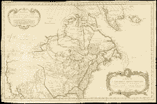
Map of Northern America..., by M. Bellin, 1755
|
| This map shows the geographic relationships between the European colonial spheres of power on the eve of the Seven Years War. Three European nations shared the North American continent: France occupied the north and centre, England the east coast, and Spain, the south. NMC 21057 |
|
|
|
|