|

|

 |
||||
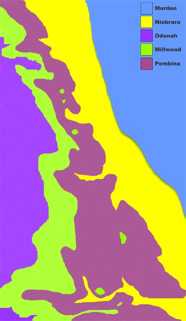
Palaeontologists begin their search for fossils with a map and a rock hammer. The geological map used, shows a representation of the topography for a given area and the geological rock units present at the surface.
In order to find fossils you need to be looking in the right place and rocks for that matter. The Morden and District Museum fossils are found within the Pembina Member of the Pierre Shale Formation. We prospect the areas on the map where the Pembina Member is at the surface.
Although the map may indicate the rock unit is at the surface, overburden and vegetation must be taken into account.
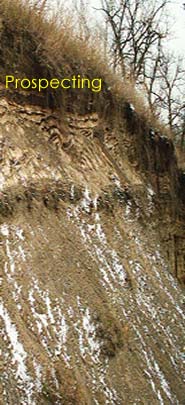
Prospecting thus begins with plenty of time and the patience to venture along the escarpment in hopes of finding a fossil. Fossils are rare and it may take several trips out in the field before one is found.
|
|
|
|
|
||||