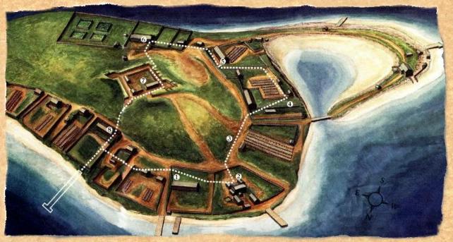
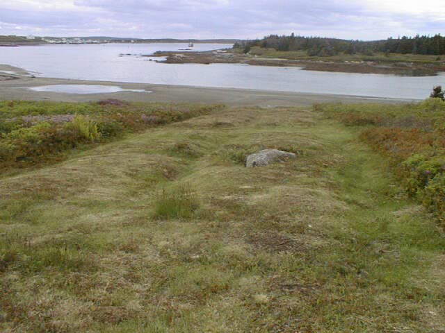
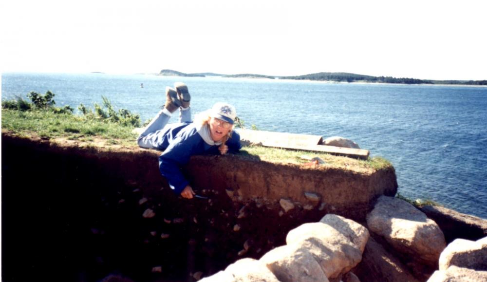
Trevett Property
 This is the first site
one encounters on the island tour. During the habitation of Grassy Island
this area once served as a duplex. The east side was owned by John Trevett,
a merchant from Marblehead, ME. and the west was owned byJohn Lumass. Trevett
traded principally in fish which was processed on the mainland. There he
owned a fish room. There are records of a John Trevett in Marblehead prior
to 1729. He may have moved to Canso at that time with his wife, Anne Reith.
Trevett was a member of high society on Grassy Island. He, at one time,
served as Justice of the Peace on Grassy Island. Trevett also owned one
of the two wharves marked on the island. There is a path which leads up
from a wharf to his house.
This is the first site
one encounters on the island tour. During the habitation of Grassy Island
this area once served as a duplex. The east side was owned by John Trevett,
a merchant from Marblehead, ME. and the west was owned byJohn Lumass. Trevett
traded principally in fish which was processed on the mainland. There he
owned a fish room. There are records of a John Trevett in Marblehead prior
to 1729. He may have moved to Canso at that time with his wife, Anne Reith.
Trevett was a member of high society on Grassy Island. He, at one time,
served as Justice of the Peace on Grassy Island. Trevett also owned one
of the two wharves marked on the island. There is a path which leads up
from a wharf to his house.
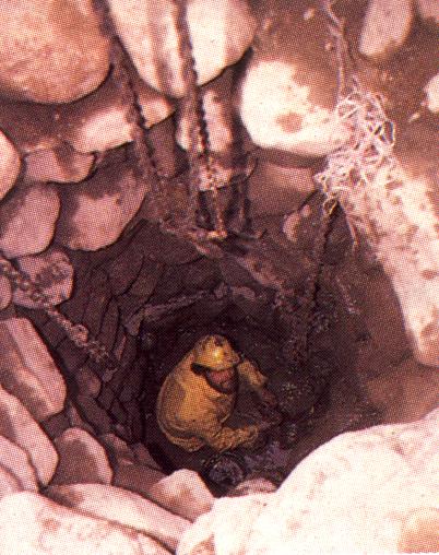
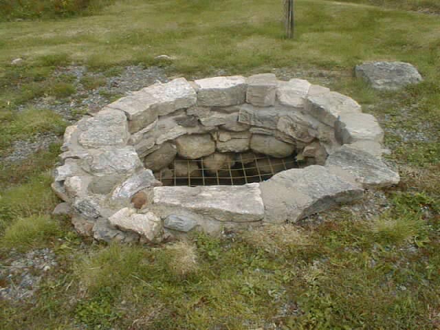
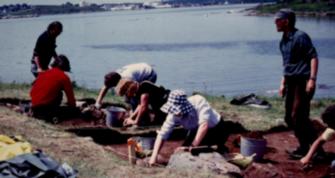
Each end of the building is marked by separate cellar depressions. A stone lined well is located behind Trevett's house. The well had been filled in with stones previously so it took some work to excavate it in 1981. Wells are often seen as potential "goldmines" for Archaeologists as inhabitants would often use the well like a "trash bin" of sorts. This well wasn't as productive as they had hoped but nonetheless, they found a brass button at the bottom of the well.
As a side note, when they were excavating the well, the first item they encountered was a mechanical pen, definitely not of the 18th century (hehe). They speculate that the well had been filled in to protect the live stock which grazed on Grassy Island. Possible the owner of the livestock, while filling in the well, accidentally dropped his pen in at the same time.
Edward How Property
 Edward How is considered
the most successful merchant that had resided on Grassy Island. He served
various positions including Justice of the Peace, and head of the militia.
He was integral in Britain/Indian relations and often arbitrated between
the sides in treaties. He was assassinated in 1750, probably due to his
alliances and trading partners. His property was the most extensively excavated
on the island. It included a residence which consisted of two wings, and
three storehouses ( two of which held military supplies). There was also
a garden area, a shed on the side of the house and garbage dumps (middens)
at either end of the house, these dumps were filled with debris from the
18th century occupation. How also owned the island's largest
wharf.
Edward How is considered
the most successful merchant that had resided on Grassy Island. He served
various positions including Justice of the Peace, and head of the militia.
He was integral in Britain/Indian relations and often arbitrated between
the sides in treaties. He was assassinated in 1750, probably due to his
alliances and trading partners. His property was the most extensively excavated
on the island. It included a residence which consisted of two wings, and
three storehouses ( two of which held military supplies). There was also
a garden area, a shed on the side of the house and garbage dumps (middens)
at either end of the house, these dumps were filled with debris from the
18th century occupation. How also owned the island's largest
wharf.
Remains of the foundation, chimney bases, window glass and other debris were found on site. Evidence also suggests that the New England militia, who used the island as a base for the attack on Louisbourg in 1745, used How's brewing oven as a place for manufacturing musket balls. Lead scrap, musket balls, and food debris were found around the oven and building walls. Fragments of fine ceramic glass objects were found which had come from as far away as China, Turkey and Europe. Also found in the garbage dumps were remains of a dog which was probably the family pet. Many food scraps were found which consisted of the bones of sheep, cattle, pigs, chicken, seal, and oyster shells.
Elliot Property
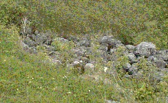
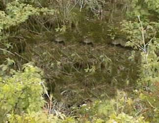
This property was located next to Edward How's and was owned by John Elliot. His home today is marked only by a shallow cellar depression. Elliot was a fish merchant and was active in the Canso fishery since 1722. He was mainly noted for leading a counter attack against a raiding party of Mi'kmaq natives. His property was used primarily for processing cod. The cod was spilt, salted and then laid out on wooden tables called flakes to dry. The remains of the flakes are still visible and consist of five long parallel ridges. When excavated, fragments of bottles, jars, and clay tobacco pipes were found.
Cosby Property
 Alexander Cosby, the 18th
owner of this next site on our virtual tour, was the commanding officer
of the Garrison from 1721 to 1727 and again in 1937. He died in Fort Anne(Annapolis
Royal) in 1742. Most likely his wife Anne remained at Fort Anne after her
husbands death, but maintained ownership of the Grassy Island property.
Alexander Cosby, the 18th
owner of this next site on our virtual tour, was the commanding officer
of the Garrison from 1721 to 1727 and again in 1937. He died in Fort Anne(Annapolis
Royal) in 1742. Most likely his wife Anne remained at Fort Anne after her
husbands death, but maintained ownership of the Grassy Island property.
A large rectangular stone mound with a deep cellar pit marks what is left of this property today, with fish flakes located below the house. No longer visible are traces of a crude wooden shack that were unearthed. Found at this time were fragments of bottles and jars, which were dated from the 17th century. The shack was probably used by French fishermen in the summer where they would dry their fish on the gravel spit below. Remains of one of the eleven taverns were found down closer to the shore. A wineglass, mug, and bottle fragments were found here substantiating the existence of a tavern. Broken clay pipes and a homemade gaming piece chiseled from porcelain were also found.
The Aldridge Property
This site was once the property of Captain Christopher Aldrigde, commander of the garrison in 1743. The property contains the remains of a large house and well which is still visible near the walking trail. Sloping down the hill are parallel ridges which used to be fish flakes. Ironically the military were supposed to be forbidden from dealing in the fishery. Captain Christopher Aldridge however did not seem to heed these warnings even though he had even sent a warning to other military personnel about dealing in the fishery.
The Heron and Jephson Properties
 The inhabitants of
this property were Capt. Patrick Heron and John Jephson, both of whom were
officers of the garrison. Heron was acting commander of the garrison during
the French raid of 1744. This property was a duplex near the fortress. Archaeologists
were especialy concerned about this site due to its location. It is next
to a cliff which has been eroding rapidly over the past 200 years. Because
of this, much of Heron and Jephson's property has been lost, having been
reclaimed by the Atlantic Ocean. This site was therefore a priority. Various
objects were recovered from the site including fragments of a fine earthenware
plate, remains of a musket, and fragments of an exploded shell. This indicates
that this area of the island was probably under heavy attack during the
raid of 1744.
The inhabitants of
this property were Capt. Patrick Heron and John Jephson, both of whom were
officers of the garrison. Heron was acting commander of the garrison during
the French raid of 1744. This property was a duplex near the fortress. Archaeologists
were especialy concerned about this site due to its location. It is next
to a cliff which has been eroding rapidly over the past 200 years. Because
of this, much of Heron and Jephson's property has been lost, having been
reclaimed by the Atlantic Ocean. This site was therefore a priority. Various
objects were recovered from the site including fragments of a fine earthenware
plate, remains of a musket, and fragments of an exploded shell. This indicates
that this area of the island was probably under heavy attack during the
raid of 1744.
Fort William Augustus
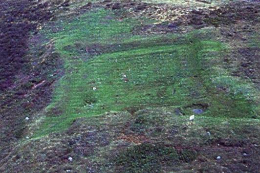
This site is home to a small wooden and sod fortress built in the early 1720's to give limited protection to the inhabitants of the island. The English government, concerned about the French and Micmac attacks on the island, had decided to fortify the island. The fortifications were rather meagre with only a few cannons mounted on the south wall over looking the harbour passage. A powder magazine and two barracks also stood within the fort's walls. Within a few years the fortress had fallen into ruins and was virtually abandoned by the time of the French attack in 1744. The entrance to the fort is still visible at the northwest wall as well as the remains of the blockhouse. Aerial photography shows the outline of the fortress which is very apparent.
The Garrison Church - Possible Location
Between the fort and wharf lies the largest man made terrace on the island. This has been speculated as the possible site of the garrison church. Records indicate the existence of a church on the Island. Some indicate that soldiers may have helped with the construction of a church and that there was a minister who tutored the children of the Island there for a time.