People
traveling through Saskatchewan on the main routes, usually see the
province as flat, boring and a place to get through as quickly as
possible. What many people don't realize is that they are traveling
through a vast lake bed, cut through by drainage channels and formed
as little as 12,000 years ago.
Saskatchewan
has an abundance of soil considered to be new and very fertile
by many countries whose soil has not been regenerated in many
years. During the last Ice Age mixing of soil layers, followed
by many years of plant growth on near level land produced the
rich tapestry of soils used for farming and ranching.
There
have been four icecaps in the last one and a half-million years.
Ice caps are formed when all the snow that had fallen during a
season is not melted in time for the next. Should this occur for
many consecutive years, a compacted snow area grows in size sufficient
to create its own weather, thus nurturing and maintaining weather
where very heavy snowfalls are common. Snow compacts to ice, when
the weight is great enough, the ice deforms and slowly flows.
The
first icecap left little evidence of its existence. The second
icecap about 650,000 years ago was the largest covering 31% of
North America, but with the out wash of melting waters and moraine
material, it affected nearly 60% of North America. This icecap
centered in Hudson's Bay. It extended as far south as the state
of Kansas USA is named "The Kansan." This ice cap which had a
depth of about 12,000,000 feet, sheared layers of soil from parts
of Quebec, Ontario and Northern Manitoba down to Bedrock. This
created the Canadian Shield. The soils were moved ahead of the
ice in a very watery, lumpy, slurry known as a moraine that eventually
settles, dries and becomes hill country.
On
an icecap's recession, there remain huge lakes that last until
the waters can find their way either along the frontal edge or
under the ice to return to the sea. The third icecap was called
the "Illinonian". The Fourth, "The Wisconsin" left its moraine
and lakebed almost totally in Saskatchewan, thereby giving a greater
diversity of topography than Manitoba or Alberta.
The
last ice cap left a moraine escarpment from 60 miles west of the
Manitoba border angling northwestward to Swift Current Saskatchewan,
then north northwest to Vermillion Alberta and on westward. In
most places this moraine escarpment is 400 to 550 or greater feet
in height. The southwest side being hill country the northeast
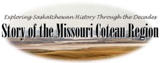
side being lakebed, flat with some deep drainage channels. The
area of Saskatchewan that this site is based on is located on
the eastern end of this hill range, roughly 2,400 square kilometers
of land. Equal to the size of the state of Montana.
Understanding
the topography of the land is instrumental to the story of the
"Traders Trail" which was used to supply trappers and forts. The
Northwest mounted police also used this trail in 1874 on their
Trek West to bring law and order to conflicts in the new west
thereby avoiding traveling through rough hill country near the
US border.