
      
�
|
Navigation
is a fundamental human interest. The urge to explore motivated humankind
to depict the environment and in doing so, invented what became known as
the map. Perhaps the fear of being lost also stretches back to our earliest
times.
The oldest known map is a small clay tablet
portraying the layout of an estate created in late 3000 BC in Sumeria.
Thus, creating maps was also driven by pragmatism as demonstrated by Egyptian
society in 1400 BC. The Egyptians made maps showing the boundaries of properties
for the purpose of levying taxes. The boundary markers were washed away
during the annual flooding of the Nile.
The further afield ancient explorers wandered
necessitated the making of maps. Some of them, those created by early Greeks--Strabo
and Ptolemy in particular--depicted the known world view. Ptolemy, for
instance, produced a mapping textbook, Geographica, that included
map projections. This volume was discovered by Renaissance scholars some
1000 years after it was created and profoundly affected mapmaking and the
field of cartography for centuries.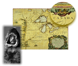
Maps then are a means of organizing information
or data, the main purpose of which is to navigate the environment. Most
often, the navigation is physical but the "journey" may be spiritual,
imaginative or contrived out of fantasy. Today too, we also navigate electronic
environments through computer databases, CD-ROMs and the Internet. Well
before the advent of computer technology (and even, the printing press)
early maps also constituted a highly regarded art form. As children we
learn to make a mental map of the route home from school before learning
how to read. We note the identifying landmarks and tuck them away for later.
The notion of "personal navigation" is thus intuitive as long
as the terrain remains friendly and familiar. Once we stray further afield,
then a map comes in very handy indeed.
|