|
|
Français | Help |
|
|
Important Notices |
|
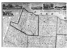
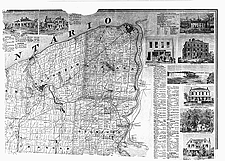
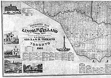
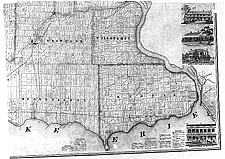
Map of Lincoln
and Welland counties, Ontario, The county map was very popular in Eastern Canada and the United States in the second half of the nineteenth century. It was the most detailed map available at the time and it echoed the vitality of the county. Fifty-nine maps of Canadian counties were produced. Catalogue entry: Ref. Nos.: NMC 019014-1, NMC 019014-2, NMC 019014-3, NMC 019014-4
|
|
|
| |