Indigenous maps from the 1700s and 1800s - Exploration - Canada at Scale: Maps of our History - Exhibitions - Library and Archives Canada
 Library and Archive Canada - Bibliothèque et Archives Canada Français | Help     Canada  
 Home > Browse Selected Topics > Canada at Scale > Exploration
  Important Notices  
Exploration, colonization and development

GO

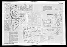
Indigenous maps from the 1700s and 1800s

This plate shows the maps drawn by the Europeans based on maps produced by Native people. The maps illustrate the ability of the Native people to depict the land. The scale of their maps takes into account the difficulty of the terrain.

The Historical Atlas of Canada, a three-volume work published between 1987 and 1993, has drawn very high praise.

Catalogue entry:
Cartes indigènes. — Not drawn to scale. — Montréal : Presses de l’Université de Montréal, 1987. — 3 maps on 1 sheet. — In Atlas historique du Canada / Geoffrey J. Matthews, cartographe et graphiste. Éd française. Montréal, 1987-1993. Vol. 1, pl. 59.

Ref. No.: C-146379

c146379

Previous   Next Return to Canada at Scale