


|
Maps
19th Century
During the 19th century, the focus of geographical exploration and mapping of unknown areas turned to the Arctic. To the south, the general outlines of the continent and of the river systems were known, and blank areas on maps were gradually being filled in. In the habitable areas of Canada, resource surveys were undertaken and land surveyors gave precision to maps through their surveys of territorial, provincial, county and township boundaries, and farm lots.
Eskimaux Chart No.1 Drawn by Iligliuk at Winter Island, 1822, by Iligliuk
Copyright/Source |
In 1818, The British Admiralty decided to undertake the exploration and charting of the Arctic. By this time it was known that there was no practical Northwest Passage, but growing scientific curiosity, and national pride, demanded that the blank northern area on the maps be filled in. Between 1818 and 1847, a two-pronged approach was launched into the Arctic by sea and over land. The sea expeditions, chiefly those led by Ross and Parry, evaluated the Eastern access points and reached the conclusion that Lancaster Sound was the main entry to further exploration. Theirs were also the first Arctic expeditions to make extensive observations of the Inuit and to make use of Inuit mapping skills. The main overland expeditions were by Franklin and Back (1833-37) and -- sponsored by the Hudson's Bay Company -- Dease and Simpson (1837-39) and Rae (1846-47). These journeys charted the northern limits of the Canadian mainland from the Foxe Basin to Alaska. Rae's expedition also showed what a small group of men living off the land could accomplish, in contrast to the massive undertakings sponsored by the Admiralty. Between 1818 and 1847 a large part of the blank areas in maps of Canada had been filled.
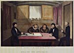
Inuit hydrographers Ikmalick and Apelagliu sketching maps of the land between Repulse Bay and Prince Regent's Inlet
Copyright/Source |
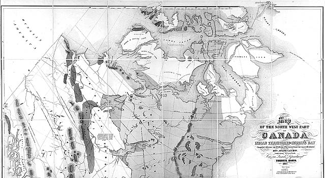
Map of the North West Part of Canada's Indian Territories and Hudson Bay, by Thomas Devine, 1857
Copyright/Source |
In 1845, the attention of the Admiralty shifted again to a major sea expedition, with John Franklin in command of 129 men in two ships. In 1847, when nothing had been seen or heard of them, the first search expedition was sent out. By 1854, after 65 major and minor searches had been undertaken, John Rae returned with proof of a major Franklin disaster. Ten expeditions later, Francis Leopold McClintock confirmed the likelihood that there were no Franklin survivors. An accomplishment of these search expeditions was the charting of the Arctic Islands to 125° west longitude and 78° north latitude.

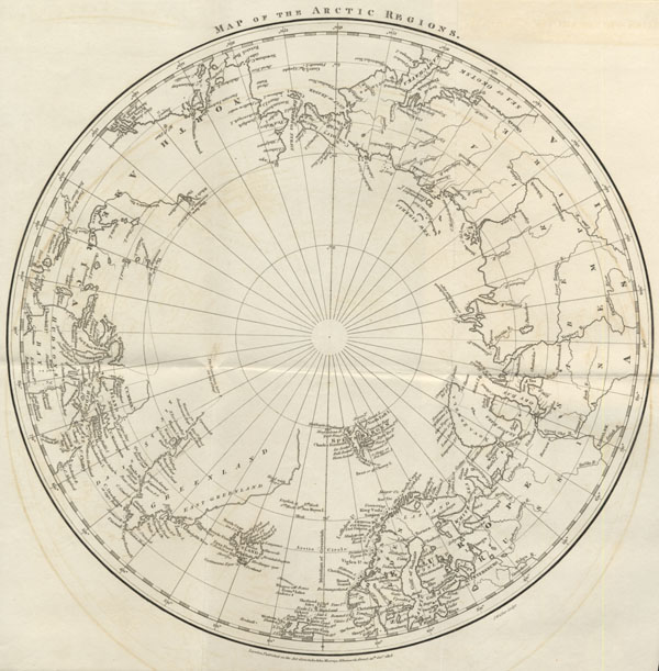
Map of the Countries Round the North Pole, by Aaron Arrowsmith, 1896
Copyright/Source |
After 1860, as further geographical details were being filled in around the Arctic Islands, attention shifted to the North Pole. Major American, British and Norwegian expeditions made an attempt to be the first to arrive there. Finally, the American Robert Peary claimed to have reached the Pole on April 6, 1909. A British Admiralty map published in 1896 illustrates the achievements of the 19th century.
While the main aim of all the Arctic expeditions was geographical exploration, most had also scientific interests. Observations on climate, geology, botany, mammals, fish and insects were ordered by the sponsors of expeditions -- sponsors such as the Admiralty, the Royal Society and the Royal Geographical Society. As reports were published and specimens brought home, scientists had access to them and prepared the first specialized scientific maps of Canada. In 1842 the Geological Survey of Canada was founded and sent out expeditions to expand on previously collected data.
The revolution in scientific reporting took a new turn mid-century when large expeditions were sent out just to collect scientific data. In 1857, the British expedition led by John Palliser and the Canadian one led by Henry Youle Hind made botanical, geological, climatological and topographical observations. Both assessed land quality for settlement purposes and both produced a number of maps showing their observations. These expeditions set a standard for the remainder of the century.
SIGNIFICANT MAPS OF THE PERIOD
- Arrowsmith, Aaron
- Map of Countries Round the North Pole... . 1818; 1896.
- [Barrow, John]
- Map of the Arctic Regions. 1818.
- [Map of the Lands Around the North Pole]. 1846.
- Blodget, Lorin
- Comparison of Temperatures of the Temperate Latitudes of the Northern Hemisphere. In Blodget, L. Climatology of the United States and the North American Continent. Philadelphia: J. B. Lippincott, 1857, opposite p. 210.
- British Admiralty
- Chart of the North Polar Sea... . (Prepared under the supervision of Captain Washington), 1855 -- revised in 1859.
- Devine, Thomas
- Map of the North West Part of Canada Indian Territories and Hudson Bay. 1857. (Crown Lands Dept., Toronto, March 1857.) Toronto: Maclear and Co. Lithographers.
- Hind, Henry Y.
- A General Map of the Country between Red River & LakeWinnipeg...Explored...1858. In British North America, Reports of Progress,.... Presented to both Houses of Parliament by Command of Her Majesty, August 1860. London: Eyre and Spottiswoode, 1860.
- Iligliuk
- Eskimaux Chart. No. 1. Drawn by Iligliuk at Winter Island 1822. In Parry, W.E. Journal of a Second Voyage... . London: John Murray, 1824, Vol. 2, p. 185.
- Isbister, Alexander
- Geological Sketch Map of the Northernmost Parts of America. 1855. In Quarterly Journal of the Geological Society of London. Vol. II, 1855, Plate XIV, facing p. 497.
- Logan, William
- Geological Map of Canada and Adjacent Regions. 1864.
- Palliser, John
- A General Map of the Routes in British North America... . 1865.
|