


|
|
|
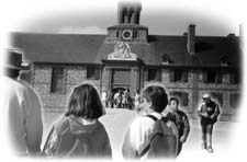
DOMINION Coal production in Dominion began in 1829 when the General Mining Association of England opened a drift mine in the cliff along the shoreline. A horse-drawn railroad ran from the mine across the beach to a shipping pier at Lingan Harbour. The mine closed in 1849 but was re-opened in 1884 and was acquired by the Dominion Coal Company in 1893. Shortly thereafter, the company opened Dominion No. 1A, the first of the many collieries it was to operate in Cape Breton. The Town of Dominion, incorporated in 1906, takes its name from the coal company. Over the years, the lives of many coal miners have prematurely ended in mine accidents. Each of the mining towns has erected memorials to these men; Dominion’s is located in a small park at the intersection of Mitchell Avenue and Commercial Street. DOMINION BEACH One of the finest and most popular beaches on the island is located in Dominion. A narrow strip of land one and one-half miles in length, it fronts on the Atlantic Ocean and Lingan Bay. Two miles of boardwalk traverse the beach and ample parking is available. A modern beach house contains a canteen, change house, showers, washrooms and a first aid facility. Wind surfing is a popular sport both at ocean side and at bay side. A boat launch is accessible from the parking lot to the bay. HERITAGE SCHOOL HOUSE MUSEUM The Dominion Heritage Museum and Information Center is situated adjacent to the beach along Highway 28. An 1888 vintage one-room school house is located at the original site and has been completely restored. It contains early desks, chalk boards, slates, as well as artifacts, photos and other documents relating to the early history of the community. An information center is staffed by guides during the tourist season. Lingan Bay is considered a birder’s paradise. An elevated observation platform is connected to the building and large binoculars and scopes are provided for bird watching along the waters.
RESERVE MINES This former mining community gets its name from the large coal reserves located there. But it is better known for its association with co-operatives and Father Jimmie Tompkins of the Antigonish Movement fame. Parish priest at St. Joseph’s Roman Catholic Church in 1934, Fr. Tompkins sparked the drive toward adult education in Cape Breton. In 1935, he established Cape Breton’s first "public library" in the front porch of his dwelling. Fr. Tompkins saw books as a source for economic and social renewal and said that people should read them to "...be able to know a fool when they see one." His work at Reserve Mines resulted in the first self-help co-operative housing development in North America. A group of coal miners formed a housing co-op; they borrowed a total of 22,000 dollars and worked together to construct eleven dwellings. The loan was used to pay for materials and each man’s personal contribution was his labour. The houses were first occupied in 1938 and continue to be occupied today at Tompkinsville. A cairn marking the event is located there. The first credit union in Nova Scotia opened in Reserve Mines in 1933 when coal miners and their neighbours united to establish their own "bank." It is now located in Tompkins Place, a commercial building constructed in 1993 by a non-profit community group. It houses a museum honouring Fr. Tompkins and his work in the co-operative and credit union movements. RESERVE AIRPORT Air travellers to Cape Breton touch down at Reserve Mines. Formerly called the Reserve Airport, its name was changed to Sydney Airport in the early 1950s.
NEW WATERFORD
DAVIS SQUARE Davis Square is located on Plummer Avenue in the town’s business sector. It is dedicated to the role which trade unionism played in New Waterford's history and is named for Bill Davis, a miner killed by coal company security forces on June 11, 1925. The company was attempting to support its unstable financial structure by the imposition of a wage cut. A vicious strike followed. In retaliation, the company cut off the town’s water supply. The community responded with a march on the water pumping station at Waterford lake to try to restore services. During a resulting confrontation, Mr. Davis was shot and instantly killed. Since that day, June 11th has been known as Davis Day. The collieries are not worked and the day is observed as a civic holiday in the mining towns. A monument in the square tells the story of the 1925 strike. Other monuments are the town’s War Memorial and a monument to the memory of the 65 miners who were killed in an underground explosion in No. 12 colliery on July 25, 1917. COLLIERY LANDS PARK Colliery Lands Park is located on the site of two abandoned coal mines, Nos. 12 and 16. A mine fatality monument serves as the focal point of the park and remembers some 300 men who met their deaths in the New Waterford area collieries. Their names are inscribed on eight granite tablets which are centred by a large mural depicting a scene associated with a fatal mine accident. To the rear are 15 national flags representing Canada and the victim’s countries of natural origin. Also on the site is a memorial to coal miner Earl Leadbeater who is entombed in No. 12 Colliery, trapped there by an underground fire in 1973. Another display features seven rail hopper cars which were used to haul the coal to market. A representative mine slope, complete with man rake cars and coal boxes, is located near the original mine entrance. The New Waterford and District Historical Society’s offices are located on the grounds. The society maintains an excellent collection of photographs, documents and artifacts related to the area’s history. FORT PETRIE Sydney Harbour played an important role during World War II as an assembly point for supply ships prior to their crossing the Atlantic. A coastal defence network was established to protect the port and its fleet from enemy attack. One part of this network, Fort Petrie, was placed at Victoria Mines. Although undeveloped, the site is both maintained and accessible. A non-profit society acquired the property and is preparing plans for its historical preservation. SCENIC DRIVE The Colliery Route continues on to Sydney’s Whitney Pier where the coal docks of the International Coal Shipping Piers are located. The drive is a very scenic one which affords a beautiful panorama of Sydney Harbour and the shores of North Sydney and Sydney Mines. It offers an excellent vantage point to view the Newfoundland ferries as they enter and leave port. |
|
The History |
The Future
Regional Impact | Mining Techniques | The Museum Main | Glossary | Site Map | Text Only |

Created by Virtual Media Productions Ltd., © 1997.
|
 The village of Lingan (its name is a corruption of the French word "l’indienne") is one of the area’s earliest settlements. In the early 1700s, French explorers from Fortress of Louisbourg settled there and extracted coal from cliff side seams at the ocean’s edge. Large scale mining operations at Lingan started in 1852, however, the first tangible signs of community life did not appear until the period 1907-1911 with the opening of four collieries at New Waterford. Over the years a total of 11 mines have been in production. Today there is only the Cape Breton Development Corporation’s Phalen Colliery. Phalen is highly mechanized and produces a daily average of 10,000 to 12,000 tonnes of coal with a work force of about 900. Its working face is located out under the Atlantic Ocean, about 5˝ kilometres offshore.