Introduction
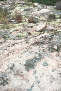
In recent years rock and mineral collecting has aroused the interests of many North Americans. The search for minerals in hopes of making a decent living has resulted in both profitable and unprofitable experiences. Veins of mineral deposits have been found all around the Missisagi River Valley area. The general area has been known for its copper deposits for many years.
There are numerous deposits of copper all around the area, and some such as the Grand Portage Mine, which dates back as far as 1864, have been mined. Around 1910 in Kynoch four prospects were developed. Two were turned into mines, but only one had any recorded production.
However, other mines were built in the area which were productive, giving more reason for the area to be known for its minerals. A copper mine called Cheney or Grand Portage Mine on the Mississagi River, now flooded under Tunnel Lake, northwest of the Mississagi River bridge, was operating as far back as 1864. The much newer Cheney mine is up the road, three quarters of a mile south of Chub Lake and five miles north of Tunnel Lake. It is just south of a Bell relay tower. Further up the road is another copper mine called Gould Mine. It is two miles north of Chub Lake where an access road turns west for about a mile and a half. Down Highway 554 about three miles off Highway 129 there is a very small copper mine called the Don Dolan Mine. It is located on a hill in the center of a farm. About five miles further down Highway 554, up the dirt road by the Bellingham Church, is the High Tower Mine. As you can see there is good reason for the area to be known for its copper deposits, and mineralization.
There are many other mineral deposits in the area, most of which have not been mined because of their location and the small percentage of minerals within the deposits. Such places are near Blinko Lake, Snowshoe Creek, Wakomata Lake, Bells Falls, Baird Lake, Chub Lake, Grasett Lake, Harten Lake, Highland Lake, Pearl Lake, and Skirl Lake. There are also many smaller deposits, some of which have been checked with a diamond-drill, to reveal little or none of the desired minerals. An example of this would be near Wawiyay Lake where the drill went to a depth of 3211 feet, and no mineralization was reported.
Resources Consulted:
Chandler, F.W. 1976. Geology of the Saundes Lake Area, District of Algoma; Ontario Divisions of Mines, Geoscience Report 155, p.34-37.
Robertson, J.A. and Card K.D. 1972. Geology of the Lake Huron region; Ontario Geological Servey, Geological Guidebook 4, p.185-187.
Siemiatkowska, K.M. 1977. Geology of the Wakomata Lake area, Disrict of Algoma; Ontario Division of Mines, Geoscience Report 151, p.49.
Shklanka, R. Ed. 1969. Copper, Nickle, Lead and Zink Deposits of Ontario; Ontario Department of Mines, Mineral Resources Circular No.12, p.26-27.
Return to Top