|
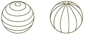
Lines of latitude circle the Earth in east-west-parallels which are at right angles to the Earth's axis. The value of lines of latitude increases in towards North or South from the zero degree line around the middle of the Earth. What is another name for that zero degree line of latitude? Lines of latitude increase from the equator at 0 to the North or South pole at 90 degrees. Do some research and find out what the latitudes are for the Arctic and Antarctic Circles.
Lines of longitude circle the Earth from North Pole to South Pole parallel to the Earth's axis. Lines of longitude increase in value, east or west, away from the zero degree line of longitude called the Prime Meridian. Because there is no natural vertical 'middle' to the Earth, the Prime Meridian is defined as the North to South circle that passes through the town of Greenwich, England (the reason for this is historical: Greenwich was the site of the British Royal Observatory and of the telescope used to make the astronomical observation on which the longitude system was originally based). Longitude lines increase in value from 0° at the Prime Meridian to 180° at the International Date Line. What country does the International Date Line pass through? Why is it called an International Dateline? What do dates and time have to do with longitude? Hint: Do some research on time zones.
Both latitude and longitude lines represent divisions of a circle and are measured, like circles, in degrees, but also minutes, and seconds. There are 60 minutes in a degree, and 60 seconds in a minute. Why do minutes and seconds represent divisions of a degree?
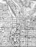
Reading Latitude and Longitude on a Topographic Map
On topographic maps, the latitude and longitude coordinates are given at each corner of the map, and along the sides of the map in the margins..
Look at a map of the world and find the Prime Meridian and the equator. What do you notice about North America? All of North America is west of the Prime Meridian and north of the equator. Because of this, all longitude coordinates are west (W), and all latitude coordinates are north (North). Notice that the longitude numbers increase from right to left and that the latitude numbers increase from bottom to top.
|
| |
Click on image to enlarge
|
|
The latitude and longitude grid is very useful for locating a map on the globe. But telling someone the precise location of a particular point on a topographic map can be tricky because the typical United States Geological Survey (7 ½-minute) map only shows four marked lines of latitude and longitude. What's more, it is time-consuming and not a good practice to try to guess at points that lie between marked lines.
|