


![[graphic]](91/h3-vtb00.jpg)
|

|
Maps, page 2
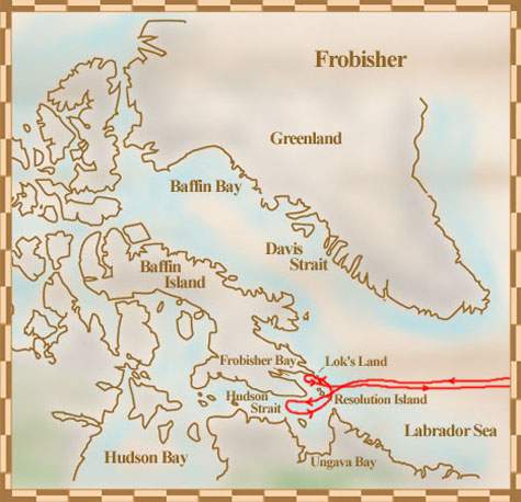
Martin Frobisher's voyages
 |
 |
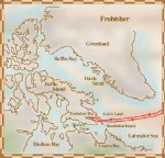
Frobisher discovered the bay now known as Frobisher Bay, off of Baffin Island. Frobisher thought that the bay was a strait between Canada and Asia
Copyright/Source |
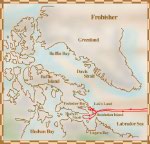
On his third voyage, part of Frobisher's fleet mistakenly entered what is now called Hudson Strait before realizing that they had gone the wrong way
Copyright/Source |
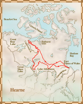
Samuel Hearne's voyages
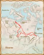 |
Hearne's third expedition was successful thanks to the help of Matonabbee and his six wives
Copyright/Source |
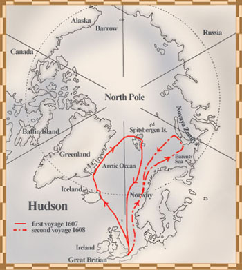
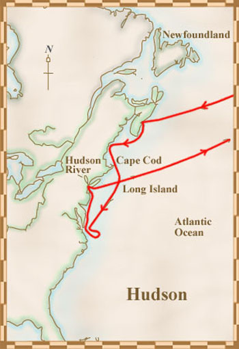
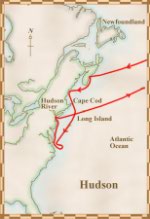
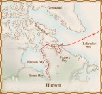
Henry Hudson's voyages
 |
 |
 |
Hudson hoped to find a short route to Asia by going over the North Pole
Copyright/Source |
Hudson gave up his route over the North Pole when his crew almost mutinied; he explored America instead
Copyright/Source |
On his fourth voyage, Hudson thought he was close to Asia when he found what is now known as Hudson Bay
Copyright/Source |
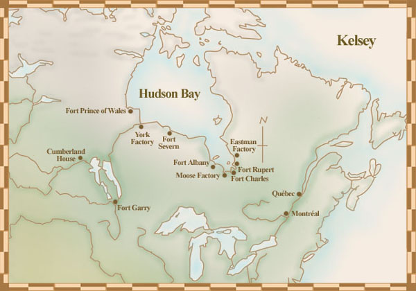
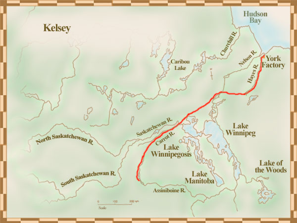
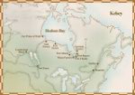
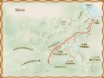
Henry Kelsey's voyages
 |
 |
Kelsey was the first to deliver letters between settlements -- a task he completed with the help of a Native boy
Copyright/Source |
Kelsey travelled southwest with the help of the Native people and was the first European to see the Canadian Prairies
Copyright/Source |
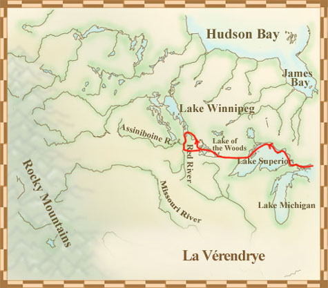
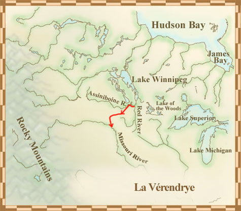
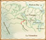
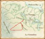
The La Vérendryes' voyages
 |
 |
 |
In 1732, the La Vérendyres set up two trading posts at Lake of the Woods
Copyright/Source |
La Verendyre was so busy with the fur trade that he had little time to explore
Copyright/Source |
It took years to learn about the complicated river and lake networks
Copyright/Source |
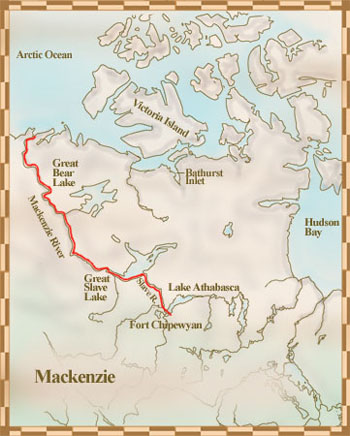
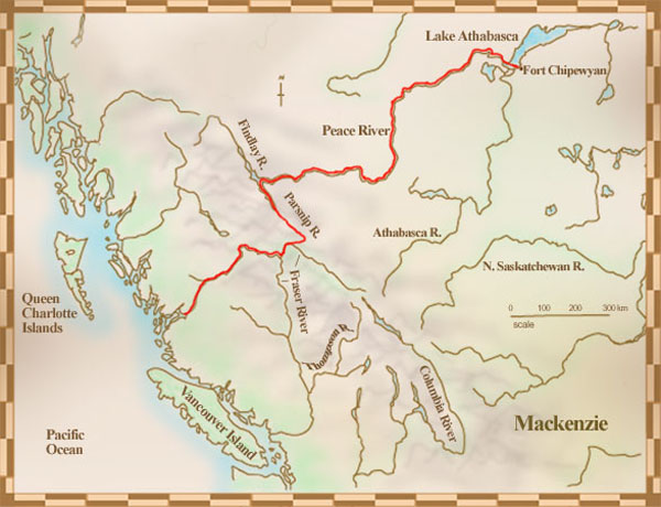
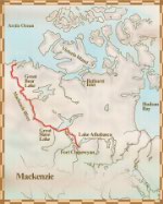
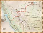
Alexander MacKenzie's voyages
 |
 |
In searching for a route to the Pacific Ocean, Mackenzie discovered what is now known as the Mackenzie River
Copyright/Source |
Mackenzie successfully reached the Pacific Ocean on his second voyage
Copyright/Source |
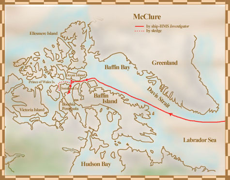
Robert McClure's voyages
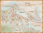 |
McClure and his shipmates searched the Arctic for Franklin and his crew, continuing by sledge when their ship became frozen in ice
Copyright/Source |
David Thompson's voyages
George Vancouver's voyages
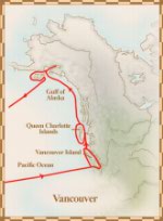 |
Vancouver and his expedition members mapped the west coast of North America from what is now northern Mexico to present-day British Columbia
Copyright/Source |
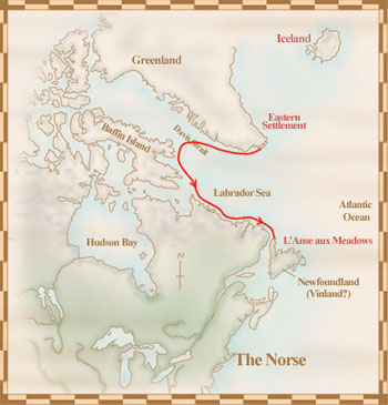
Viking exploration in North America
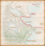 |
The Vikings were the first Europeans proven to have crossed the Atlantic and to have lived in North America
Copyright/Source |
|