|
MAPPING EARLY VANCOUVER
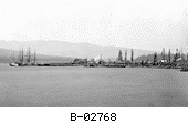
Burrard Inlet
Return to Mapping section
As a major
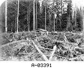
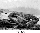
transportation link water played an important role in Vancouver's development. Timber was gold to the early settlers. Most of the early settlements in what is now Vancouver developed as company towns clustered around sawmills. Both Hastings Townsite and Moodyville began as mill settlements.
(Roy 1980) The deep and sheltered waters of Burrard Inlet made it a perfect place to load timber onto the ships which would transport it down the coast to the growing cities in the United States.
The rugged North Shore of Burrard Inlet defied settlement for a while but even this harsh landscape is now heavily developed. (Mac
Donald 1996)
To explore more of Old Vancouver click on a community name listed below. Moodyville - Granville townsite - Hastings townsite - West End - Burrard Inlet - False Creek
|